← Home · Slopes & Walls

Sheffield Slope Stability Analysis: BS EN 1997 & Eurocode 7 Geotechnical Assessment

Together, we solve the challenges of tomorrow.

LEARN MORE →

Sheffield's topography isn't gentle. The city sits where the Pennines dip into the Don Valley, with slopes carved through Carboniferous shales, sandstones, and thick head deposits. Over 60% of South Yorkshire's recorded landslides occur on engineered slopes in the Pennine Coal Measures Group — a formation that runs beneath much of the city's western suburbs. When we assess a slope here, we're not looking at textbook geometry. We're dealing with weathered mudstone interfaces, relic shear surfaces from post-glacial creep, and groundwater perched in fissured sandstone layers. A slope stability analysis in Sheffield must account for these local conditions. BS 5930 and BS EN 1997-1:2004 define the framework, but real accuracy comes from coupling site-specific shear strength testing with pore pressure monitoring. For projects on former industrial land, we often integrate CBR road testing when the slope abuts a highway corridor, ensuring the subgrade won't compromise the stability assessment.

A 1-metre rise in perched groundwater within Coal Measures shale can drop the factor of safety on a 25-degree slope below 1.0.

Process and scope

Sheffield's elevation ranges from 29 m AOD in the Don Valley to over 500 m in the western moorlands. This 470 m vertical spread creates drainage gradients that accelerate weathering on north-facing slopes. A standard slope stability analysis here uses limit equilibrium methods — Bishop's simplified or Spencer's method — but the input parameters have to be local. We've logged cohesion intercepts as low as 2 kPa in remoulded shale fill from Victorian-era tipping sites. That's not a number you'd find in a generic database. The analysis workflow starts with a detailed geomorphological walkover, then moves to rotary coring through the weathered zone. We measure residual strength on pre-sheared surfaces using the Bromhead ring shear apparatus. Peak strength comes from multi-stage triaxial testing under consolidated-undrained conditions with pore pressure measurement. All lab work runs through our UKAS-accredited facility to ISO 17025 standards. The output is a factor of safety computed for both drained and undrained scenarios, with sensitivity runs on groundwater level — because in Sheffield, a wet winter can raise the phreatic surface 3 metres in fractured sandstone.
Sheffield Slope Stability Analysis: BS EN 1997 & Eurocode 7 Geotechnical Assessment
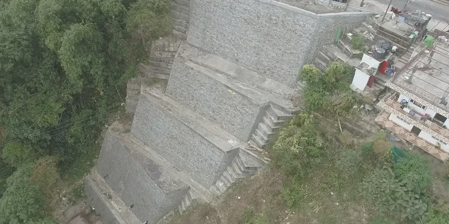
Technical reference image — Sheffield

Local geotechnical context

The dry summers and increasingly wet winters in South Yorkshire create a repeated shrink-swell and saturation cycle in the weathered zone. Desiccated clay fissures open during August, then act as preferential flow paths when autumn rain hits. Pore pressures build faster than drainage can relieve. We've seen slopes in the Loxley Valley fail on a Tuesday morning after 40 mm of rain in 6 hours — no warning, just a rapid translational slide along a pre-existing shear surface in the mudstone. Another Sheffield-specific risk is unrecorded mine entries and shallow bell pits from 18th-century coal and ganister extraction. Collapse of a crown hole near the slope crest introduces tension cracks that propagate backward. Our analyses include a mining risk overlay — we cross-reference Coal Authority records before finalising the geological model. A slope stability analysis here that ignores mining legacy isn't worth the paper it's printed on.

Need a geotechnical assessment?

Reply within 24h.

Email: info@geotechnical-engineering.biz

Explanatory video

Typical values

ParameterTypical value
Analysis methodBishop simplified, Spencer, Morgenstern-Price
Shear strength inputPeak and residual c', φ' from triaxial + ring shear
Groundwater modelSteady-state and transient seepage (SEEP/W or manual)
Factor of safety target1.3 (temporary works), 1.4-1.5 (permanent per BS EN 1997)
Seismic coefficient kh0.05-0.10 per UK seismic hazard (Eurocode 8)
Core logging standardBS 5930:2015 with Rock Mass Rating (RMR)
Lab accreditationUKAS ISO 17025 for triaxial and direct shear

Associated technical services

01

Limit Equilibrium Modelling

2D slice analysis using Slide or Slope/W with non-circular slip surface search. Calibrated against Sheffield Coal Measures material models with pore pressure grids from monitoring data.

02

Back-Analysis of Failed Slopes

Reverse-engineering the shear strength at failure to calibrate design parameters. Essential where undisturbed sampling is impossible — common in Sheffield's stony head deposits.

03

Soil Nail & Anchor Design Verification

Stability checks for reinforced slopes using limit equilibrium with reinforcement elements. Includes pullout capacity verification against BS 8081 and long-term corrosion loss calculations for steel in Pennine groundwater chemistry.

Reference standards

BS EN 1997-1:2004 (Eurocode 7, Part 1), BS 5930:2015+A1:2020 (Site investigation code), CIRIA C760 (Guidance on embedded retaining walls and slopes)

Questions and answers

What's the typical cost range for a slope stability analysis in Sheffield?

For a single slope cross-section with lab testing and a factual report, budgets run between £920 and £3,030 depending on whether we need to drill and instrument a borehole for groundwater monitoring. A desk-study-only assessment sits at the lower end; a full investigation with multi-stage triaxial testing and pore pressure data reaches the upper end.

How long does the analysis take from instruction to report?

A desk-study assessment with simplified modelling takes 10 working days. If site investigation drilling is needed, add 3-4 weeks for rig mobilisation, core logging, lab testing, and modelling. We can accelerate the lab programme when the programme is tight — talk to us about priority scheduling.

Do you account for mining voids in the stability model?

Yes. We pull Coal Authority mine entry and seam outcrop data as a standard layer in the geological model. If a crown hole or shallow working falls within the slope's influence zone, we model the void as a cavity and check for progressive collapse propagation into the slope face.

What factor of safety does Sheffield City Council accept?

Planning conditions in Sheffield generally follow BS EN 1997 recommendations: 1.3 for temporary works slopes and 1.4-1.5 for permanent slopes depending on consequence class. For slopes affecting highways, the council may request sensitivity runs with a 1-in-200-year groundwater level.
Location and service area

We serve projects in Sheffield and surrounding areas.

View larger map