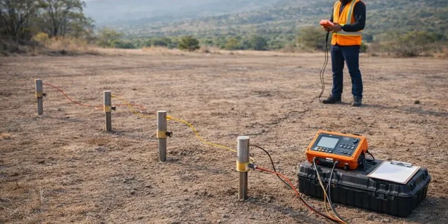
Engineering geophysics in Sheffield provides a non-intrusive lens into the subsurface, transforming how we manage ground risk for construction, remediation, and environmental assessment. This category encompasses a suite of techniques designed to map buried structures, characterise soil and rock mass properties, and delineate contamination without the need for extensive excavation. In a city where industrial heritage intertwines with ambitious regeneration, understanding what lies beneath the surface is not just a technical requirement but a fundamental safety and cost-control measure. Methods such as seismic profiling and electrical surveying allow engineers to bridge the gap between discrete borehole logs, creating a continuous model of the ground.
Sheffield's geological framework is a classic product of the Pennine Coal Measures Group, overlaid by a complex patchwork of Quaternary drift, historic fill, and alluvial deposits along the River Don and its tributaries. The bedrock is predominantly interbedded sandstone, siltstone, and mudstone, a sequence that often presents abrupt vertical and lateral variations in strength and stiffness. More critically, the city's 19th and 20th-century steelmaking legacy has left a mantle of anthropogenic ground, including slag, rubble, and undocumented backfilled quarries. These artificial deposits can be highly heterogeneous and prone to differential settlement or the generation of hazardous ground gases, making accurate geophysical mapping essential for any redevelopment on brownfield sites.
Regulatory compliance in the UK, and specifically within Sheffield, is heavily influenced by the need to satisfy the National Planning Policy Framework (NPPF) and its technical companion, the Land Contamination Risk Management (LCRM) guidelines. For seismic site classification, British Standard BS EN 1998-1:2004 (Eurocode 8) mandates the determination of the average shear wave velocity in the upper 30 metres, a parameter known as Vs30. This directly connects to our MASW / Vs30 (shear wave velocity) surveys, which are the industry-standard method for acquiring this data. Furthermore, the investigation of potentially contaminated land requires a phased approach where geophysics can screen large areas efficiently, guiding subsequent intrusive sampling in line with BS 10175:2011+A2:2017.
The application of geophysics spans a wide spectrum of projects across Sheffield. Residential and commercial developments on former industrial land routinely demand a detailed assessment of ground stability and contamination pathways. Infrastructure projects, such as the city's Supertram extensions or highway improvements, rely on these methods to locate voids and assess rippability along proposed routes. For environmental due diligence, Electrical resistivity / VES (Vertical Electrical Sounding) surveys are particularly effective in mapping leachate plumes from historic landfill sites or delineating the extent of buried foundations and storage tanks. Even smaller-scale domestic extensions can benefit when building near retaining walls or in areas with a known history of shallow mine workings, where a rapid geophysical scan can de-risk the investment.
The primary purpose is to non-intrusively investigate the subsurface to identify buried hazards, map geological variations, and determine engineering parameters like shear wave velocity. This is crucial in Sheffield due to widespread made ground and former mine workings, allowing developers to design foundations and remediation strategies based on continuous ground models rather than isolated borehole data.
The city's extensive steelmaking legacy has produced a complex subsurface of slag, backfilled quarries, and buried structures. These materials often exhibit strong contrasts in electrical resistivity and seismic velocity compared to natural strata, making electrical and seismic methods highly effective. The choice of method is tailored to detect these specific anthropogenic features, which pose risks of differential settlement and contamination.
BS EN 1998-1:2004, or Eurocode 8, is the key standard. It requires the calculation of the Vs30 value—the average shear wave velocity in the top 30 metres—to classify a site's seismic response. This classification directly influences the design ground accelerations used in structural engineering, ensuring buildings in Sheffield are resilient to low-to-moderate seismicity and, more critically, to ground shaking from historical mining collapse.
Geophysics is a pre-cursor and complement to intrusive work like drilling and trial pitting. It provides continuous spatial coverage, identifying anomalies between boreholes that would otherwise be missed. This targeted approach means intrusive points can be positioned to investigate specific features, verify geophysical interpretations, and calibrate results, leading to a more accurate and cost-efficient overall ground investigation.
We serve projects across Sheffield and its metropolitan area.